A scientific first for Onera in understanding the impact of deforestation on climate change
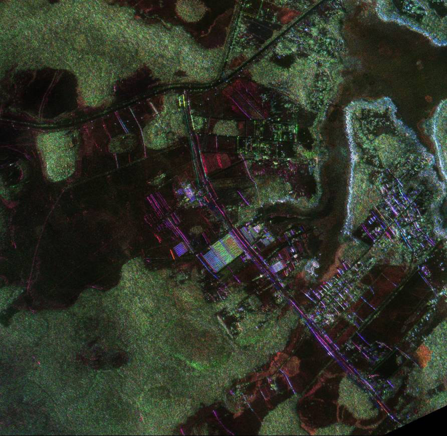
Fragment of an SAR* UHF polarimetric image of the "Paracou" tropical rain forest (Guyana) obtained with the Onera Sethi* system for the Tropisar* project. This image covers about 12kmx8km with a resolution of 1m. The Biomass* satellite will have a resolution of 50m. [DEMR]
How can we better monitor the flows of carbon and better understand the impact of deforestation on climate change? With a measurement instrument capable of precisely quantifying the geographical distribution and the variations over time of the biomass of forests. This will be the objective of the Biomass* satellite which, if it is selected by the ESA, will be in operation in 2016.
Whence the idea of developing a method of remote radar sensing of biomass* that would allow for a precise estimation for forests on the scale of the planet. This is the method that was tested in the forests of French Guyana from August 6 to September 1, 2009 with the Tropisar campaign, a key step in the preparation of the Biomass mission.
On the eve of the Copenhagen summit of December 2009 on global warming, when the data was still being analyzed, the first images were impressive. Comparison of the results with the in situ measurements will determine how the project will be continued.
Images from this airborne measurement campaign conducted in French Guyana by Onera’s on-board sensor, Sethi*, designed and developed by the Onera Salon de Provence teams.
[Click on the image to enlarge]
Surroundings of Rochambeau Airport, French Guyana. The green color indicates a "depolarization" of the incident wave back-scattered by the medium, which is greater the denser the vegetation.
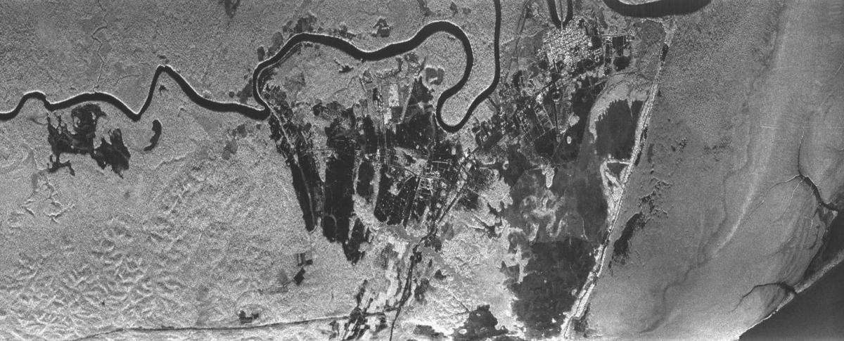
SAR image of mud banks, Guyana.
Glossary
- Tropisar
Tropisar is a key step in the preparation of the Biomass satellite mission. The purpose of the Tropisar campaign, carried out by Onera in collaboration with Cesbio and the Toulouse laboratory "Evolution and Biological Diversity" on behalf of the ESA and CNES, is to conduct a series of measurement operations using radar data for the forests of Guyana.
The Guyana forest, a perfect example of a tropical forest, is one of the most difficult forests to map because of its density. However, scientists have a lot of existing ground measurements, made to monitor the forest dynamic. Once the radar data acquired by Sethi* has been processed, the Onera scientists will compare the biomass data obtained by the airborne method with what they already have in order to evaluate the precision of the system of remote sensing of forest biomass, planned for the Biomass project.
"With Sethi, Tropisar will provide a test cartography of the biomass of tropical forests," says Pascale Dubois-Fernandez, Tropisar Project Director. "The Sethi images have the same characteristics as those obtained by the radar detectors proposed for the Biomass candidate satellite. They will provide an initial view of the potential of this mission in the tropical regions. While the data is currently being sorted and processed, we should be able to give the ESA usable data as of June 2010." - Biomass
The Biomass satellite is one of the 3 competing missions in the running to become the seventh satellite of the ESA Earth Explorer scientific program, devoted to earth observation issues. "Biomass represents a real scientific challenge," says Malcom Davidson of the ESA. "This would be the first satellite able to generate a complete cartography of the forests of the planet every 35 days and the first remote sensing satellite to operate on such a large wavelength, with deployment of an antenna of 15 to 27 meters when in orbit. Before committing the 220 million euros necessary for its development, not including operation, we have to demonstrate the value of the method and its efficacy in monitoring flows of carbon." - Biomass (remote radar sensing of)
Biomass is a reservoir of carbon. Biomass: dry weight of ligneous matter (wood) + foliage (leaves). Mass of carbon = 0.5x biomass. The measurement technique used is based on the interaction of the electromagnetic wave emitted by the on-board antenna with the ligneous mass of the forest (wood). This technique depolarizes the electromagnetic wave and this effect is all the greater the denser the forest. The simultaneous measurement of the height of the forest with the polarimetric interferometry technique means then that we can calculate the biomass. - SAR - Synthetic aperture radar
A radar technique that uses the displacement of the antenna to obtain an angular resolution much greater than that of a static antenna. The angular resolution of an antenna is inversely proportional to its size, which is necessarily reduced on board an aircraft. - Sethi
New generation on-board radar imagery system designed by Onera for scientific surveys. It was developed and certified in 2007 and produces radar images of the ground, during the day and at night, regardless of the weather conditions. "Its applications are multiple, in both the military and civil domains (remote sensing, archeology, study of the environment)" explains Olivier Ruault du Plessis of the Electromagnetism and Radar Department.
Under the wings of the Falcon 20 are two pods with a carriage capacity of up to 250kg each which house the three high and low frequency radars, indispensable for airborne remote sensing operations, and which constitute the Sethi multi-mode system. "This facility, operational since 2008 and certified by the European Aviation Safety Agency, is unique in Europe," confirms Olivier Ruault du Plessis, Manager of the Radar Imagery and Experimentation Unit of Onera.