TERRISCOPE, a platform for the development of airborne imagery to benefit society
TERRISCOPE is a research platform dedicated to airborne imagery for studying the environment and territories. TERRISCOPE is aimed at promoting the emergence of new services, especially from the drone line. Its development has started in January 2016 and will take 3 years.
TERRISCOPE combines two fixed-wing drone platforms with a variety of energy efficient and compact sensors. Primarily financed by the Languedoc Roussillon Midi-Pyrénées region and by ERDF** funds from the European Union, the use of this platform synergizes the expertise and resources of ONERA and SAFIRE*, a public instrumented research aircraft operator. TERRISCOPE will in particular function together with LIMA, the ONERA laboratory for the use of remote sensing data, developed with the support of the Midi-Pyrénées region, Toulouse Métropole (the city of Toulouse and some of its suburbs) and the ERDF. LIMA was inaugurated in 2013.
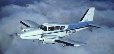
Piper- Aztec aircraft belonging to SAFIRE, a partner in the project ©SAFIRE
The work carried out by ONERA with TERRISCOPE, in association with public bodies and industrialists, is in particular aimed at promoting the development of services based on airborne remote sensing.
In addition to some isolated applications dedicated to environmental issues (for example, the identification of energy losses from buildings, the determination of surface water stock and the determination of renewable energy production potential), the focus will be particularly on services resulting from gathering data over extensive areas and/or areas with complex geometries (metropolitan dynamics, the functioning of large scale agricultural and forestry operations and natural resource management). Another area will focus on the inspection of extensive industrial and civil infrastructures: production sites, great lines and large buildings.
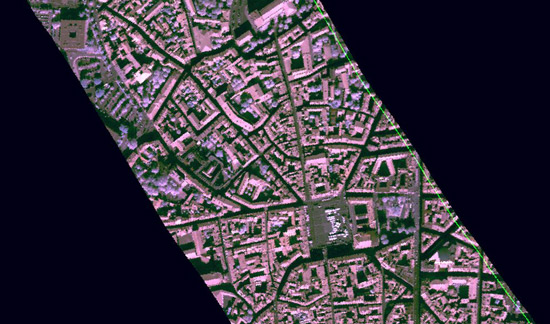
Infrared image extracted from a hyperspectral image taken by the Hyspex near-infrared camera ©ONERA
The platform work revolves around three lines:
- The establishment of airborne measurement capability with various fixed-wing drones, as well as compact or miniaturized systems: next generation hyperspectral imagers, full-waveform topographic 3D LIDAR and multispectral infrared cameras.
- The pre-processing and archiving of these new data with LIMA, as well as the calibration and operational maintenance of new sensors.
- Strengthening of the current airborne measurement capabilities on board existing SAFIRE aircraft, particularly with the integration of some of the sensors acquired for the drones and the development of an onboard LIDAR for wind field measurements in the lower atmospheric layers
The resources implemented and shared will be available to the regional and national scientific and industrial communities.
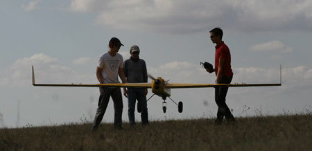
ONERA’s Avion Jaune (yellow aircraft) drone in operation ©ONERA
*SAFIRE, joint service unit of Météo France, CNRS-INSU (Sciences of the Universe) and CNES
**ERDF: European Regional Development Fund, a European structural fund aimed at strengthening economic and social cohesion by correcting regional imbalances.
![]()